
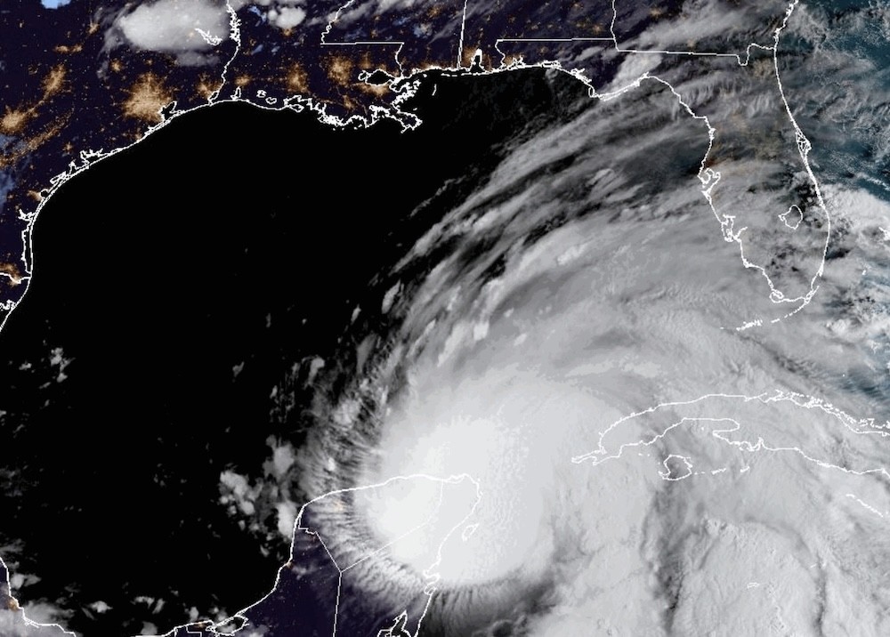
According to the National Hurricane Center's 8 a.m. advisory, the center of the storm was located about 60 miles east-northeast of Cozumel, Mexico and 100 miles west-southwest of the western tip of Cuba.
Its sustained winds have increased to 70 mph and are moving near 9 mph. Tropical-storm-force winds extend up to 175 miles from the center. Helene is expected to pick up speed Wednesday and Thursday, potentially reaching Florida's Gulf Coast late Thursday as a major hurricane.
"Over the Southeastern U.S., Helene is expected to produce total rain accumulations of 5 to 10 inches with isolated totals around 15 inches," NHC says. "This rainfall will likely result in areas of considerable flash and urban flooding, with areas of significant river flooding."
All of East Central Florida has been upgraded to a tropical storm warning, which can include wind gusts up to 50 to 60 mph and localized flooding, according to the National Weather Service. A few tornadoes cannot be ruled out, they say.
NWS says conditions will become too dangerous for storm prep by Wednesday night. Tropical storm conditions can be expected in the warning area, which includes Orange, Seminole, Osceola, Lake, Okeechobee, Volusia, Brevard, Indian River, St. Lucie and Martin counties.
Conditions are expected to deteriorate Wednesday night into Thursday morning.
Subscribe to Orlando Weekly newsletters.Wed 9/25 6:30 AM | Here is a detailed look at some of the potential impacts from #Helene across East Central Florida. Gusty winds are likely tomorrow, along with locally heavy rain. There is also a risk for tornadoes beginning late tonight through tomorrow. #FLwx pic.twitter.com/dnJ8xUsAWM
— NWS Melbourne (@NWSMelbourne) September 25, 2024
Follow us: Apple News | Google News | NewsBreak | Reddit | Instagram | Facebook | Twitter | Or sign up for our RSS Feed
